Our Services
We provide overall project management and planning using proven methods and tools. We call on our broad relationships with other professionals in the industry to provide skillsets and support for additional services, as well.
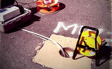
Environmental Site Assessments
Environmental Site Assessments
Environmental Site Assessments (ESAs) are integral to all land development projects.
Read more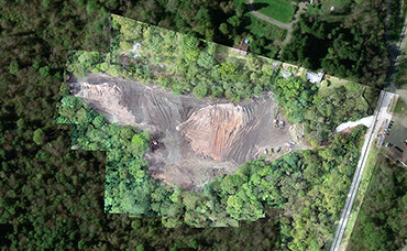
GIS Services
GIS Services
The success of your project depends on receiving environmental permits in a predictable fashion and on time.
Read more
Drone Services
Drone Services
Big Pine Consultants LLC is always working to innovate and use the latest technology to support our clients needs.
Read more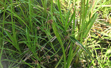
Rare, Threatened, and Endangered Species
Rare, Threatened, and Endangered Species
Big Pine Consultants (Big Pine) provides real-world solutions to align project goals with state and federal regulatory compliance, as well as community values by teaming with other leaders in habitat and wildlife ecology.
Read more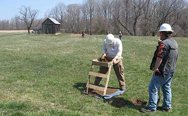
Archaeology and Historic Properties
Archaeology and Historic Properties
We know that artifacts and remains from our Nation’s rich heritage can influence your time-sensitive project.
Read more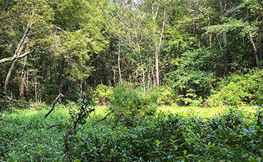
Wetland/Stream Studies and Permitting
Wetland/Stream Studies and Permitting
Balancing needed development in our region with managing wetland and waterway resources is a challenge facing many permit applicants.
Read more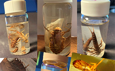
Aquatic Macroinvertebrate Sampling and Identification
Aquatic Macroinvertebrate Sampling and Identification
Big Pine has biologists skilled in both sampling and identification of aquatic macroinvertebrates.
Read more
Project Management and Planning
Project Management and Planning
The success of your project depends on receiving environmental permits in a predictable fashion and on time.
Read more
In-House Services
- Project Management
-
Wetland Delineation and Waterbody Identification
-
Phase I, II, and III archaeological investigations
-
Consultation regarding rare, threatened and endangered species
-
Northeastern bulrush (Scirpus ancistrochaetus) surveys in PA
-
Consultation regarding historic properties
-
Clean Water Act Section 401/404 permitting (or respective state equivalent)
-
GIS mapping and desktop routing for linear projects
-
Geological Investigations and Environmental Site Assessments
-
Phase I
-
Phase II
-
Soil sampling/Core sampling
-
Monitoring well installation
-
Groundwater sampling/low-flow groundwater sampling
-
PADEP Act II Site Investigations
-
Stray gas sampling and mitigation
-
Vapor Intrusion
-
Geotechnical investigations
-
Geohazard investigations
-
-
Drone Services, FAA Part 107 Licensed and Insured*
-
Aerial Orthoimagery
-
Plant Health Maps
-
Contour Maps
-
3D Models
-
Point Clouds (.LAS files)
-
Real Estate Photography
-
Videography for Bridge Inspections
-
- Civil and Environmental Engineering
- Roadway Permitting (utility and drives)
- Erosion and Sediment Control Plans
- Stormwater / NPDES
- Grading
- Traffic Control Plans
- Environmental field routing walks
-
Line list preparation and tracking
-
Permit tracking table preparation and updates
-
Conference call coordination and project updates
-
Scheduling / Gantt chart updates
-
Budget tracking
-
Landowner requests for permission to survey
-
Field routing reviews for environmental features
-
Macroinvertebrate surveys in streams, lakes, and ponds (where permitted)
-
Fish sampling in streams, lakes, and ponds (where permitted)
-
Water quality sampling (various chemistry parameters)
-
NEPA documentation, including FERC prior notices and simple 7c filings
-
Public outreach support
-
Government relations support
-
Public / open-house meeting preparation and support
-
Current deed searches and coordination with abstractors for full title
-
Appraisal coordination with local appraisers
-
Easement document preparation and coordination of legal reviews
-
Easement negotiation and coordination to close with landowners
-
Easement recording
-
Landowner notifications during planning and construction
Additional services with teaming arrangements
-
-
Various rare, threatened, and endangered species surveys
-
Historic architecture reviews
-
Civil Survey
-
Construction Alignment Sheets
-
Easement Exhibit / Plat preparation
-
As-built survey
- Air Quality Permitting
-
-
-
Title Abstracting
-
Property Appraisals
-
FERC Environmental Reports
-
Horizontal Directional Drill plans and details
-
Underground utility locating
-
Easement encroachment agreements
-
Environmental monitoring during construction
-
Utility inspection
-
Pipeline engineering
-
The lists above are not all-inclusive. Additional services may be available in addition to those described above. As Big Pine Consultants LLC grows, our in-house services will expand, as well. If you have a challenging project and are looking for direction or support, please give us a call! We’re here to help!
* Big Pine Consultants LLC is not currently licensed to provide survey services and does not currently employ a licensed surveyor. Although Big Pine can incorporate the use of ground controls into workflows to improve accuracy, the drone services provided by Big Pine Consultants LLC are not “survey grade” and cannot be relied upon for legal, engineering, or surveying. If the data is to be used for these purposes, Big Pine Consultants LLC will contract with a state licensed surveyor to provide data for such uses. Please notify Big Pine Consultants LLC of the planned uses of data when requesting drone services.
WV Small Business Vendor #VS0000021856, PennDOT Small Business Enterprise – Business Partner ID 015115
CAGE Code: 83UV7, EIN: 82-5441344, DUNS: 081222161
NAICS Codes: 541620 Environmental Consulting, 541330 Engineering Services, 541618 Other Management Consulting Services